Nukuoro (Nukuoro Municipality)
Nukuoro is an atoll in the Federated States of Micronesia. It is a municipality of the state of Pohnpei, Federated States of Micronesia. It is the secondmost southern atoll of the country, after Kapingamarangi. They both are Polynesian outliers. , Nukuoro had a population of 372, though several hundred Nukuorans live on Pohnpei. Fishing, animal husbandry, and agriculture (taro and copra) are the main occupations. A recent project to farm black pearl oysters has been successful at generating additional income for the island's people.
Nukuoro is remote. It has no airstrip, and a passenger boat calls irregularly only once every few months. The island has no tourism except for the occasional visit by passing sailing yachts. There is a 4-room schoolhouse but children over the age of 14 must travel to Pohnpei to attend high school.
The total area, including the lagoon, is 40 km2, with a land area of 1.7 km2, which is divided among more than 40 islets that lie on the northern, eastern, and southern sides of the lagoon. By far the largest islet is Nukuoro islet, which is the center of population and the capital of the municipality. The lagoon is 6 km in diameter.
Traversable by foot during low tide, the islets of Nukuoro (called modu) are separated by narrow waterways during high tide. These modu form a chain that is perceived by residents as starting from the southwestern terminus (ngage "the front") to the northwestern terminus (ngaiho "the back"), in a counterclockwise direction. Direction when traveling along the atoll is relative and is determined by the terminus one is moving towards (i.e., one is 'going ngage ' when moving away from ngaiho, and vice versa). This is true no matter which side of the atoll one is proceeding on. The largest islet, Nukuoro, which gives its name to the atoll, also affects direction on the atoll: when traveling towards Nukuoro, one is said to be 'going hale ' ("home"), rather than 'going ngage/ngaiho.'
The lagoon itself also serves as a reference point to determine relative direction. Movement towards the lagoon, the center of the atoll, is called i dai ("on the water"), while movement outwards in the direction of the open ocean is called i dua ("on the back").
Map - Nukuoro (Nukuoro Municipality)
Map
Country - Federated_States_of_Micronesia
 |
 |
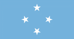
| Flag of the Federated States of Micronesia | |
While the FSM's total land area is quite small, the country's waters occupy nearly 3 e6km2 of the Pacific Ocean, giving the country the 14th-largest exclusive economic zone in the world. The sovereign island nation's capital is Palikir, located on Pohnpei Island, while the largest city is Weno, located in the Chuuk Atoll.
Currency / Language
| ISO | Currency | Symbol | Significant figures |
|---|---|---|---|
| USD | United States dollar | $ | 2 |
| ISO | Language |
|---|---|
| EN | English language |


